Data
Global datasets and site datasets are available.
Global
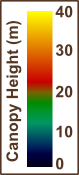
Global Canopy Height
Derived from ICESat/GLAS and environmental modeling.
- Low resolution KMZ, 10 km | download (1 MB)
- Full resolution GeoTIFF, 1 km | download (68 MB)
- Error map GeoTIFF | download (51 KB)
- Legend (PNG) | download (15 KB)
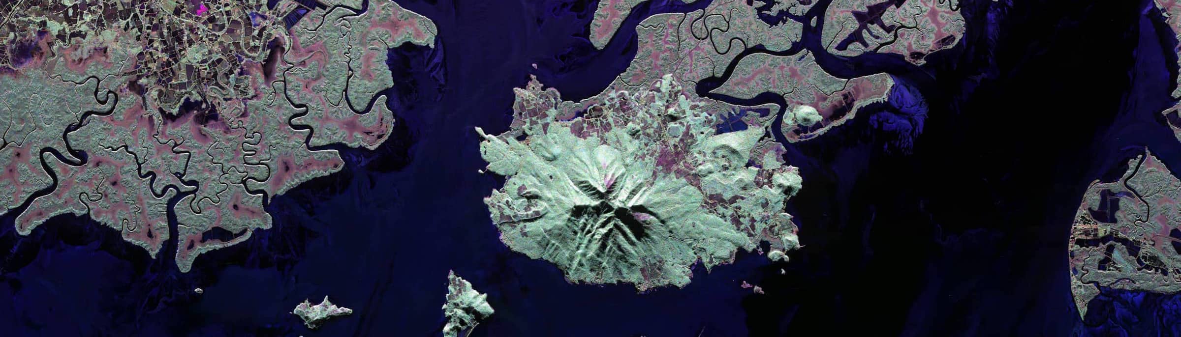
Gabon Estuary
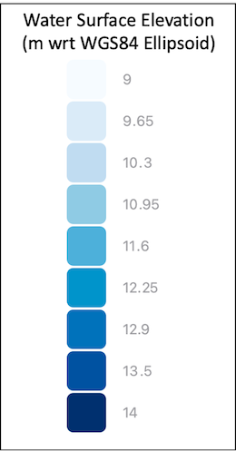
Water Surface Elevations from ANUGA Model Simulations
This dataset contains water surface elevations produced from an ANUGA model simulation of the Gabon Estuary. Water surface elevations are related to the WGS84 ellipsoid.
- Water surface elevations KMZ | download (1 MB)
- Water surface elevations GeoTIFF | download (81 MB)
- Legend (PNG) | download (58 KB)
GEDI Level 2B Data
Available GEDI level 2B version 002 data for the Gabon estuary from 2019-03-25 to 2021-12-14. Downloaded from the Land Processes Distributed Active Archive Center (LP DAAC).
- Estuary extent KMZ | download (7 KB)
- CSV | download ZIP (15 MB)
- Data dictionary (XSLX) | download (22 KB)
ICESat-2 ATLAS08 Data
Available ICESat-2 L3A Land and Vegetation Height, Version 5 (ATLAS08) data for the Gabon estuary from 2018-10-14 to 2021-12-03. Downloaded from the National Snow and Ice Data Center.
- Estuary extent KMZ | download (7 KB)
- CSV | download ZIP (2 MB)
- Data dictionary (XSLX) | download (22 KB)
Ganges Delta
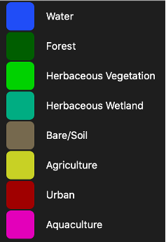
Delta Landcover
Landcover classes present in each delta (Water, Forest, Herbaceous Vegetation, Herbaceous Wetland, Bare/Soil, Agriculture, Urban/Built, Aquaculture). These products were assimilated from 2019 Copernicus Global Land Service, 2019 Global Forest Change, and additional Landsat data products.
- Landcover KMZ | download (783 KB)
- Landcover GeoTIFF | download (207 MB)
- Legend (PNG) | download (22 KB)
Delta Extent Change
Delta land gain and loss from 1999–2019.
- Land change KMZ | download (271 KB)
- Land change GeoTIFF | download (827 MB)
- Legend (PNG) | download (15 KB)
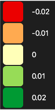
Delta NDVI Trend
The trend in NDVI across the delta, taken from the regression slope value for each pixel in the Landsat timeseries (1984–2019).
- NDVI trend KMZ | download (3 MB)
- NDVI trend GeoTIFF | download (827 MB)
- Legend (PNG) | download (15 KB)
Magdalena Delta
GEDI Level 2B Data
Available GEDI level 2B version 002 data for the Magdalena delta from 2019-03-25 to 2021-12-14. Downloaded from the Land Processes Distributed Active Archive Center (LP DAAC).
- Delta extent KMZ | download (7 KB)
- CSV | download ZIP (14 MB)
- Data dictionary (XSLX) | download (22 KB)
ICESat-2 ATLAS08 Data
Available ICESat-2 L3A Land and Vegetation Height, Version 5 (ATLAS08) data for the Magdalena delta from 2018-10-14 to 2021-12-02. Downloaded from the National Snow and Ice Data Center.
- Delta extent KMZ | download (7 KB)
- CSV | download ZIP (16 MB)
- Data dictionary (XSLX) | download (22 KB)