Inland
Forests
Forest vertical structure remains poorly characterized despite being a predictor of aboveground live biomass, primary productivity, and biodiversity.
Data from spaceborne light detection and ranging (lidar) opens the possibility to map forest vertical structure globally.
We model forest vertical structure using data from the Geoscience Laser Altimeter System (GLAS) aboard ICESat (Ice, Cloud, and land Elevation Satellite). The altimeter transmitted a 1024 nm light pulse and recorded the reflected signal (waveform). We use these data to construct a global wall‐to‐wall map of forest canopy height.
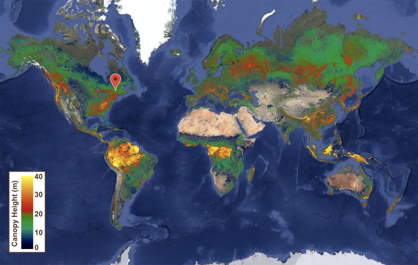
3D Global Vegetation Map derived from ICESat/GLAS and environmental modeling.